CAVAILLON - From the Station to Saint-Jacques Hill
From Cavaillon’s station and old town to Saint-Jacques Hill: an easy 4.9 km loop combining heritage, nature and a unique panoramic view.
84300, Cavaillon
From Cavaillon’s station and old town to Saint-Jacques Hill: an easy 4.9 km loop combining heritage, nature and a unique panoramic view.
84300, Cavaillon
✔ Loop – 1h45
✔ Distance: 4.9 km
✔ Marking: PR / GR® / unmarked


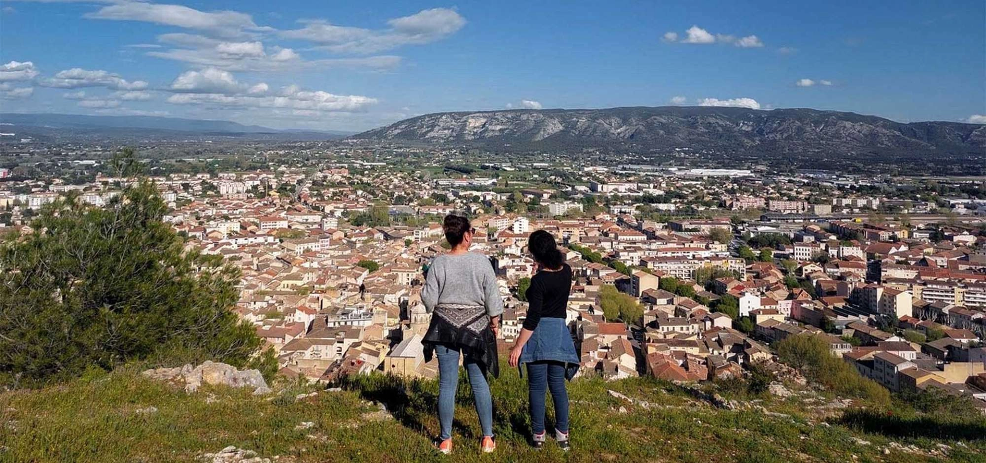
Starting from Cavaillon train station, this 4.9 km loop invites you on a journey between town and nature. Easy and accessible, it connects the lively old center with Saint-Jacques hill, a true natural belvedere overlooking the Durance valley and the Luberon massif.
The route alternates heritage and landscapes: Belle Époque façades, Roman arch and Saint-Jacques chapel follow one another before giving way to limestone paths lined with Mediterranean flora. Here, nature blends into the heart of the city, with retaining walls, rocky outcrops and 360° panoramas.
The ascent of the César de Bus climb, marked by stairways and switchbacks, opens the way to another universe. At the top, the Saint-Jacques chapel and its iconic cross offer a breathtaking viewpoint: rooftops of Cavaillon, the lines of the Alpilles, the Petit Luberon and the Durance plain all unfold in a single glance. Classified as a UNESCO Global Geopark geosite, Saint-Jacques hill illustrates the harmony between history, spirituality and preserved nature.
Short but varied, this hike is a great opportunity to discover Cavaillon in a different way, combining urban heritage with fresh air and wide-open views.
The trail is enjoyable in every season, but spring and autumn offer the best experience, with soft light, pleasant temperatures and clear views.
In summer, it is best to leave early in the morning and check the forest access conditions.
Want to extend your discovery of Cavaillon?
Around Saint-Jacques Hill, several trails let you explore this emblematic site in different ways. For example, take the Roman Road and Saint-Jacques Hill, which follows the traces of an ancient path between heritage and viewpoints. For thrill-seekers, the Via Ferrata of Cavaillon offers a unique aerial route with breathtaking views over the town, the Durance valley and the Luberon.
